Friday, November 25, 2016
On a day when many people are heading to the 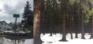 stores to begin their holiday gift shopping, I decided to go in effectively the opposite direction and try to knock out a couple of county high points. This particular effort would prove to be different than the other excursions I’d gone on earlier in the year. Let me explain…
A few weeks earlier, my mother had invited me to drive up to the Syracuse area and join them for Thanksgiving dinner. Being that I hadn’t shared a Thanksgiving with them in quite a few years, I took her up on the offer and made the drive to Syracuse on Tuesday the 22nd. Due to a spate of lake effect snow squalls over the course of the few days prior, many parts of Central New York had had 30, 40, or even 50 inches of snow dumped on them. Although the snow had abated by the time I made my Tuesday afternoon trip, the evidence of those storms was clear as I reached the Cortland County line, and then Onondaga County. Large mounds of snow on both sides of Route 81 as I passed through Preble, then Tully, and ultimately Lafayette, which looked like it had been hit hardest of all.
So anyway, after arriving safely at my folks house on Tuesday night, I relaxed and enjoyed their company for a couple of days, including Thursday’s feast. But on Thursday evening, after dinner, I decided to do some county high point research to see what might be possible within the time frame I had to work with.
After a short review, I decided that Oneida County and Madison County could probably both be accomplished within one day (or less). I considered adding Onondaga County to the plans, but it was also my father’s birthday, and I had wanted to stop by his house on the other side of town and visit with him for a few hours, so I scratched Morgan Hill off of my target list. Onondaga County would have to wait for another day.
And so on Friday morning, after drinking less than my usual daily intake of coffee, I hopped in the car and headed east from the west suburbs of Syracuse toward Oneida
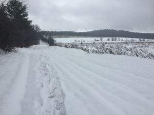 County. The drive out to Waterville, NY – the location of Oneida County’s Tassel Hill – took about an hour and 15 minutes, and was picturesque, even in the overcast weather conditions. US Route 20 was the primary byway for the trip, and was rife with rolling hills and glorious views of the Central New York countryside.
After passing through Waterville, which was a quaint town, I took White Street out about two miles in search of Tassel Hill Rd. According to Google satellite, Tassel Hill Rd would take me up to within about a half mile of the high point. By my estimation, this could make it a fairly quick hike, even with the snow. But upon reaching the intersection of White and Tassel Hill Rds, a dose of reality set in. Tassel Hill Rd, I immediately learned, is a seasonal road, and is not plowed. And so now this 1-mile hike would be more on the order of 3.5 miles. That’s 3.5 miles in heavy snow.
A bit annoyed by this discovery, but not totally put off, I got out of the car, pulled my YakTrax over my running shoes, and with a bright red shirt on (we’re right in the 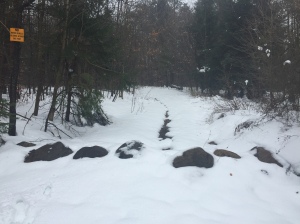 middle of hunting season, after all) began my hike up Tassel Hill Rd.
At first, the road was exposed to open fields, and there was heavy drifting. But as the road went gently upward and into the trees, the wet snow was primarily ankle deep, but no more. As I continued on, I did see a hunter quietly perched in the woods, waiting for a target to appear. He didn’t even turn his head to look at me as I plodded by.
Up to this point, I had been following the boot prints of hunters. But not long afterward, the footprints disappeared, and I found myself breaking trail as the snow got deeper and deeper. About a mile 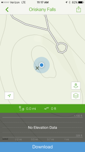 and a quarter in, I made a right-hand turn and continued to pursue the upward ascent to the top of Tassel Hill. The snow got deeper still, and by the time I reached the top, it was thigh high in most places.
After a quick look around, and the taking of a couple of snapshots, I began the 650-foot descent back to the car. The ascent had taken approximately 45 minutes, and the hike down a mere 23 minutes, which I was pleased with given the deep snow and often slippery footing.
My next task would be to find a place to gas up the car, and get a sandwich and some more coffee before proceeding to the Madison County high point some 25 miles west of Tassel Hill. After a quick stop at the Waterville Nice & Easy Quick Mart, it was onward to Morrow Mountain State Forest in the southern part of Madison County. After a 35-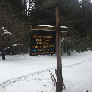 40 minute drive, I arrived at the base of Mack Rd, the main entrance into the state forest. But just like Tassel Hill Rd, this road is seasonal, and I could see from the get-go that it was going to be a push through deep snow all the way.
From the car to the summit was about 0.95 miles, with about 400 feet or so of vertical ascent. In knee deep snow, I trudged up the hill, encountering a couple of hunters along the lower portion of the climb. When I expressed to one of them that I clearly wasn’t here in the forest for the same purpose that he was, he said to me “But we’re both enjoying the outdoors, and that’s what’s important.” This made me smile.
About halfway up Morrow Mountain, I passed through a sp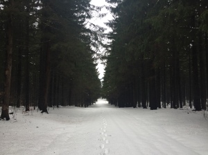 ectacular section of pine trees that inspired me to stop and take a couple of pictures. The snow depth diminished briefly here, and was only ankle deep in most places. Another 2 or 3 tenths of a mile later and I was at the summit, where there was a radio tower of some sort, and a small wooden building (not much larger than a shack) that was probably state forest property.
Having taken 23 minutes to make the climb, I made it back down in 13 minutes, bounding playfully through the deep snow along the way. At one point I heard a succession of 6 or 7 gunshots lower down the mountain. I stopped for a few moments, waiting to be sure the barrage was over, and nervous now about having it happen again as I reached the lower section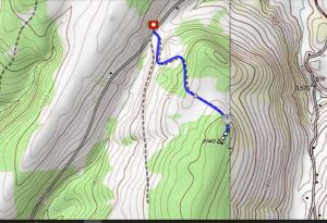 . But the hunters had seen me as I went up the hill, so I trusted that they would exercise proper caution as I passed through their area again.
By the time I reached the bottom my legs were starting to feel it. On the day, a total of about 5.4 miles of (mostly) deep snow hiking without the benefit of snowshoes, which I had unfortunately left at home before making the drive to Syracuse. Two days later, I would have muscle soreness in places that I had never had from running.
Two more CoHPs down, and now just 45 to go. How long will it take me to complete them all? Stay tuned. 🙂

 Dreams In Action – Marshall Ulrich
 Lisa Smith-Batchen's Blog
 Notes on a Running Life – Douglas Hegley
 The Long Brown Path
 NYCRUNS
 Philip Melillo Health & Fitness