
June 15, 2018
Situated in Shaker Mountain Wild Forest, a 40,000-acre land parcel managed by the New York State DEC, Pigeon Mountain ranks as #12 in height among the 62 New York county high points. Alltrails.com rates the hike as “Hard”, and after having completed this summit, I would generally concur with that assessment.
The weather forecast for most of Fulton County was for sunny with highs in the 70s. And when I stepped outside to get in the car at 5:30am, the weather in Orange County appeared to be the same. But as I traveled north on the NY State Thruway to meet my friend Joe in Clifton Park, the skies became more and more gray, and by the time I reached the parking lot of his office, it was raining.
 After greeting Joe with a frustated “What the f*ck?” as I looked skyward with palms up, he said to me “Don’t worry. This will pass.” After a brief pop-in to his office for coffee and a bathroom break, we hopped in his Howard Hanna Realty company car – a forest green Chevy Equinox – and began the 80 minute drive to the Pinnacle Rd trailhead, about 25 mins north of the city of Gloversville.
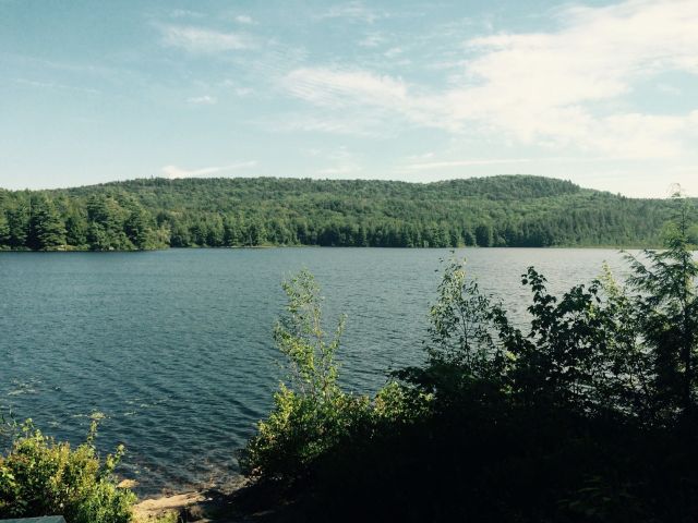
By the time we got to the trailhead, the skies were sunny and blue. There were two trails which originated from the parking lot, and after a quick consultation of our Alltrails phone app, we determined that the blue-blazed trail was the proper one to take. The first two miles of our trek were along this foot path, which meandered through a scenic pine forest, girded at times by Pinnacle Creek, which babbled melodiously, as if a symphonic instrument in nature’s morning song. Although there was some elevation gain in the first couple of miles, and a minor stream crossing as well, the going was fairly easy until we got to the 2-mile mark.
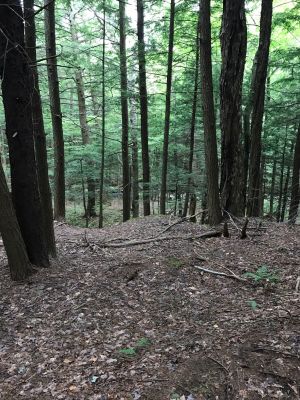
As we reached the far end of a large bog and crossed over its small inlet stream, we veered left off of the DEC trail and began the “bushwhack” portion of the hike. Ahead of us were about 8/10 of a mile of steep, fairly densely forested mountainside. At first the navigation was somewhat easy, as the slope and the density of the growth were manageable. But less than a 1/4 mile into the bushwhack, the pitch increased, and we encountered more and more obstacles – blowdowns, patches of extremely heavy growth, and a couple of steep rock faces that could not be tackled head-on.
There was nothing that we couldn’t navigate around, but between the obstacles and the ever-steepening mountain slope, the going was slow. In places it seemed like we were dealing with a 35-40% grade. As we came nearer to the summit, I frequently referred to the Alltrails map on my iPhone and began measuring our position in terms of the number of vertical feet left to go. Our progress was heavily stunted by this challenging landscape.
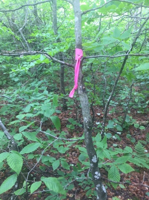
But after passing the 2600-ft mark, the slope began to level off, and we made our way relatively easily through some ferns and a mix of evergreens and deciduous trees before finally reaching the summit area. The exact high spot was unclear, visually, but we remembered reading one trip report where a hiker had said she found a tree with pink engineer’s ribbon on it. We skulked around a bit, found the tree, and declared the ascent a complete success.
Keeping my phone in airplane mode, I had been able to navigate us to the summit using the aforementioned Alltrails app. But despite my efforts to conserve the battery, my phone died just as I started taking summit photos, so Joe took over the navigation responsibility  (using his phone) on the descent back to the blue DEC trail.
The going down the mountain was a bit slower than I expected, mainly due to the steep slope, and again, all the forest’s other natural obstacles. But still, we managed to make it back to the car 15 minutes faster than it had taken us to ascend. In returning to the Pinnacle Road lot, our car was the only one there, just as it had been on our arrival nearly 3 hours prior.
We celebrated our success with a grand lunch at Druthers Brewing Company in Saratoga Springs, indulging in their fresh craft beer offerings and their famous “loaded” mac ‘n cheese. All in all it was a grand day out !
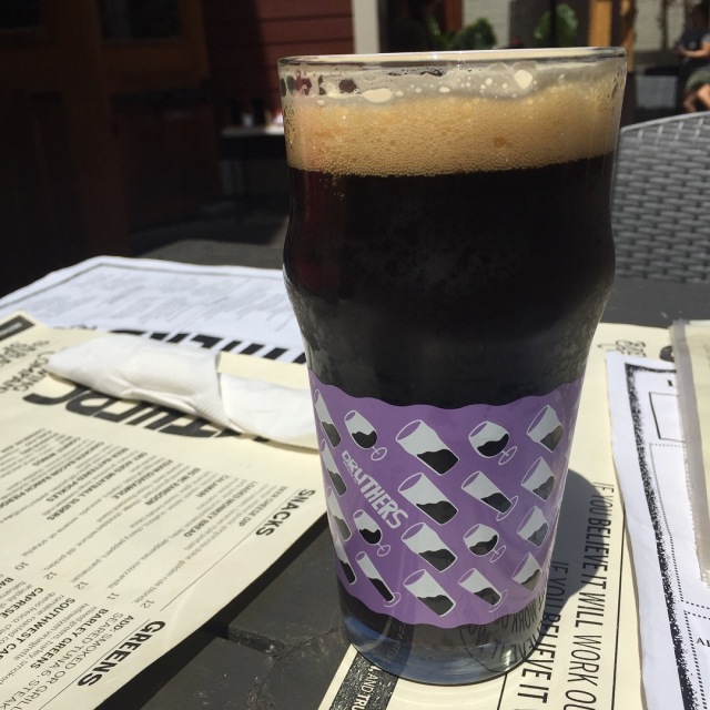
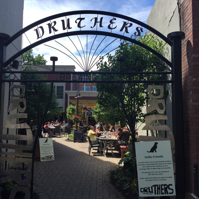
Photo credits: Kelsi Douglas, John Varin
 Dreams In Action – Marshall Ulrich
 Lisa Smith-Batchen's Blog
 Notes on a Running Life – Douglas Hegley
 rundangerously
 The Long Brown Path
 NYCRUNS
 Philip Melillo Health & Fitness


Great that you found that pink ribbon we tied up there. That was the summit!