August 12, 2018
As I said in front of most of you at the race on Sunday, I have been coming to the Catskills for CMRR since 2004, and from that very first year I have been absolutely awestruck by this event. My 2004 team was comprised primarily of friends I had made on the commuter train to New York City, and accordingly, our team name that year was “Rail Riders”, for which we had custom tank tops made. We had an amazing day, which included a teammate losing one of his running shoes – we think it fell out of the car when they were scrambling to support me as I ran up the massive hill around the 35K mark. My running mate ended up having to run his 2nd leg in someone else’s shoes, which was interesting to say the least. We ultimately finished 11th out of 12 teams, barely breaking 9 hours, and celebrated our “success” with a nice bottle of champagne at the Davis Park Pavilion.
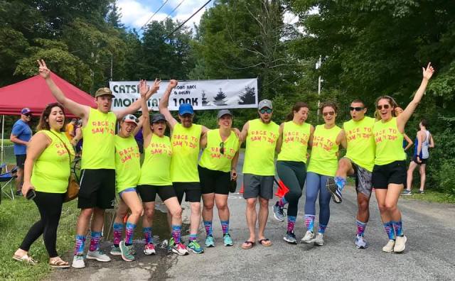
And this, my dear friends, is the beauty of the Catskill Mountain 100K. It’s less about competition, and more about the experience of sharing a grand day out with your running BFFs. And I’m confident that it is this very thing that brings teams back again and again and again. Just ask Scott Bartucca, Joe Marchesano, Scott Batten, or any of the girls from the NEPA Comeback Crew.
___________________
The 2018 race featured a record number of registered teams (22 in all), and although our solo field was smaller than in prior years, it brought a considerable amount of talent to the start line in Phoenicia. Among those solo runners was 29-year-old Cole Crosby of Princeton, NJ, a member of the Red Newt Racing Team, and who had told me that his goal for the day, if the weather cooperated, was to break 8 hours.
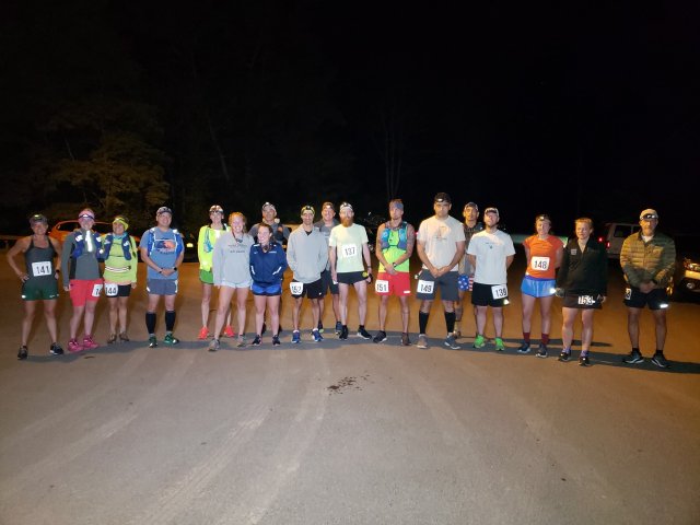
After setting up the check-in tent a little before 2:00am and then driving out Woodland Valley Road to drop the turnaround cone, I hung out under the stars and awaited the first solo runners, who would begin arriving at about 3:00am. By 3:45am, everyone who was going to be there was there, so we organized the customary pre-start group photo. 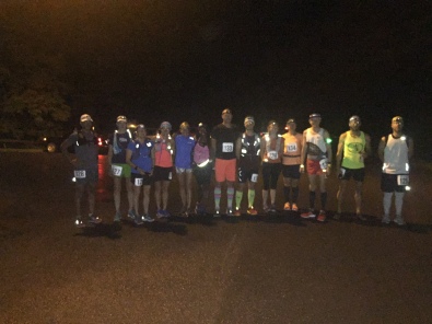 After a short race briefing, runners toed the line, I counted down to 4:00am, and they were off.
In no surprise, Cole passed through the 10K mark first in a little over 45 minutes, followed closely by last year’s solo winner Jake Brown. Jake had run the first 25 miles of the 2017 race barefoot before switching to running sandals. But based on that experience, he had begun this year’s race with sandals on, and he trailed Cole by a mere 15 seconds after 6.2 miles.
The last of the solo runners came through the 10K point at about 5:06am, at which time I gave primary focus to checking in the first wave of teams, who would begin their 62.1-mile journey at 5:30am. Team “Stop and Stretch” from Frost Valley was in that first wave. The Frost Valley YMCA camp is a splendorous property located at about the 50K mark in the course, and for several years staff there had been seeing our markings on the road and wondering what they were about. Sometime in early 2016 the runners among them figured it out, and they fielded their first team that year. After a 1-year hiatus, they were back for another race.
 Waves of successively faster teams went off at 6:00am, 6:30am, 7:00am, and 7:30am. The final wave had just two teams, one from the New York Harriers and one from the Dashing Whippets Running Team, both from New York City, and both with sights set on breaking 7 hours.
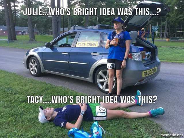
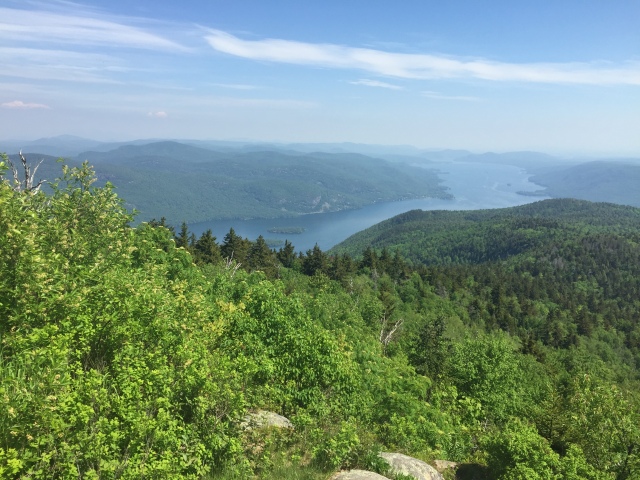
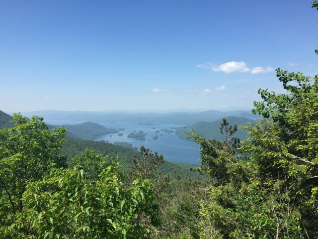
With all the teams now on their way, I packed up the start line gear and headed out onto the course to observe the progress of all the teams and solo runners, with close attention paid to safety issues. To my delight, everything was going well. I passed most of the teams along Route 28 between Phoenicia and Big Indian, and then a few more as I made my way through Oliverea and near the beginning of Winnisook Hill. About a mile before the hairpin turn, I caught up with solo runners Julie Lyness and Tacy Powers. Both had run CMRR before, and with that experience knew that if there was a portion of the course that needed to be walked, this two-mile stretch was definitely it. They gave me a smile as they walked, said everything was good, and I wished them luck before continuing on.
At the hairpin turn I came upon Enide Mitchell, who was running the first 50K as part of a 2-person ladies team, and who had started their race at 4:00am with the solo runners. She was lumbering up the hill, slowly, but also with a smile on her face. She looked good.
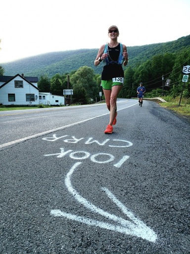
Moving on, I didn’t catch up with the next of the solo runners until I was over the big hill and past the 40K mark. I passed female race leader Lynne Fahy of Geneva, NY, who was on the heels of Jonathan Smit at about 45K. She had trailed Rhinebeck’s Sheryl Wheeler when I saw them both at the 10K mark, but had moved herself into the lead, and as it turned out, a lead she would never relinquish.
Knowing that Jake Brown had dropped out early due to back problems, I knew that race leader Cole Crosby was now the only runner between me and the finish line in West Shokan. I finally caught him about a mile before the 70K mark in Grahamsville. He was taking a short break for some refueling, and told me that his race was going well so far. He had reached this point in 5 hours, 20 minutes, which he said was roughly a 7:20/mile pace overall.
With everyone now accounted for and looking good, I drove ahead to the finish line to set up. My first volunteer, Melissa McCutcheon, arrived shortly after 10:30am, and helped me pop up the scoring tent and assemble the finish line structure. Melissa is a 3-timer at CMRR, and a two-time solo finisher. This year, in the midst of some serious hip issues, she had decided to give back to the race by volunteering. Scoring volunteers Chad Smith and Paul Reynolds arrived at a little after 12:00 noon, making us fully ready to start bringing the runners in and getting on with the post-race experience.
As Melissa and I were chatting in the scoring tent, Cole caught us somewhat by surprise, turning the corner onto Lang Rd at 12:16pm, and crossing beneath the finish line banner in a time of 8 hours, 16 minutes and 16 seconds. This absolutely smashed the course record previously held by Ithaca, NY’s Matthew Fischer-Daly, who had run a 9:10:23 in 2016. Although Cole was happy, there was a measure of disappointment in him. 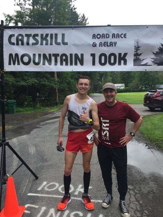 As I had gauged it based on his time back in Grahamsville, he was on track to run perhaps a 7:45. And as 11:45am had passed, and then 12:00pm with still no sight of Cole, I knew that something had gone wrong for him in that final 30K.
Attributing his struggle to the finish on an overambitious start and rising humidity late in the race, he relented and confessed that despite these difficulties, he was a happy man. The 3,600+ feet of aggregate gain, which would be nothing in a trail race of this distance, had apparently surprised him a little, and contributed to his falling slightly short of his goal time.
It would be over 2 and a half more hours before 2nd place solo finisher and overall female winner Lynne Fahy would cross the line in 10:59:13, falling just 5 minutes and 21 seconds short of Jordan Grande’s 2015 course record of 10:53:52. Lynne had a great race, seeming to manage the course extremely well, and pocketing a well-deserved win.
___________________
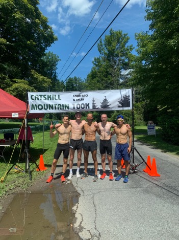
In the interim between Cole and Lynne, teams had begun reaching the finish line, most notably the team called Harriers Meow Mixed, who had entered the race with the goal 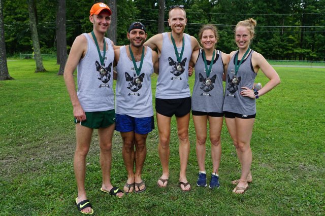 of breaking the Mixed division course record of 6:48:55. They beat that time somewhat comfortably, clocking a 6:42:39, and also coming in 1st place overall in the team races. Not far behind Harriers Meow were the Dashing Whippets Men, running a 7:04:26 and securing 1st place in the Open division.
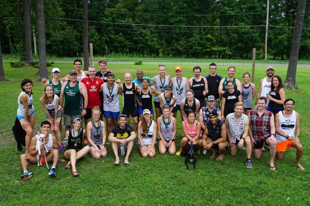
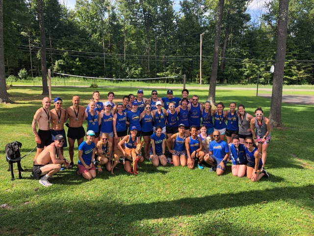
At one point, the finish line turned somewhat chaotic, as many of the teams were merging in the final approach to Davis Park, and all of their teammates were congregating to cheer their final runners in. In just an 18-minute span between 2:23pm and 2:41pm eleven teams crossed the line, making for challenging work for Chad, Paul and Melissa, who were trying to sort out which team was which as nearly 70 people clustered along the final 100 meters of the race course, some running across the finish line as a team, leaving the scorers occasionally confused about which one was the Leg 10 runner. Somehow, they were able to sort all of it out in the end, earning kudos from your race director.
Taking 1st place in the Female team division were the Donut Babes, representing the New York Harriers, and setting a new division record of 7:33:02, beating the old record 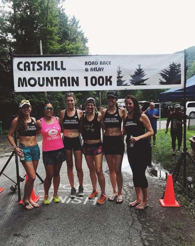 (held by the DWRT Ladies) by over 12 minutes. In 2nd place, close behind the Donut Babes, were those very same DWRT Ladies, completing the race in 7:40:06, and also breaking their own previous course record.
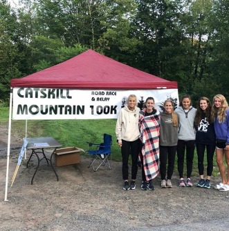
Winning the Superteam division were the young ladies from Northeast Pennsylvannia, the NEPA Comeback Crew. Team member Olivia Lanza was the only one among them to  run two legs, which included the especially difficult Leg 4. Each year, Olivia always seems to get pegged with having to make the extra effort (one year she ran Legs 1 through 3 consecutively), but I know she enjoys it, and her teammates truly appreciate her ability and commitment.
Crossing the finish line in a net time of 12:32:23 was the 2-person Masters team Sole Sisters, comprised of Enide Mitchell and Heather Freilich. These ladies are both in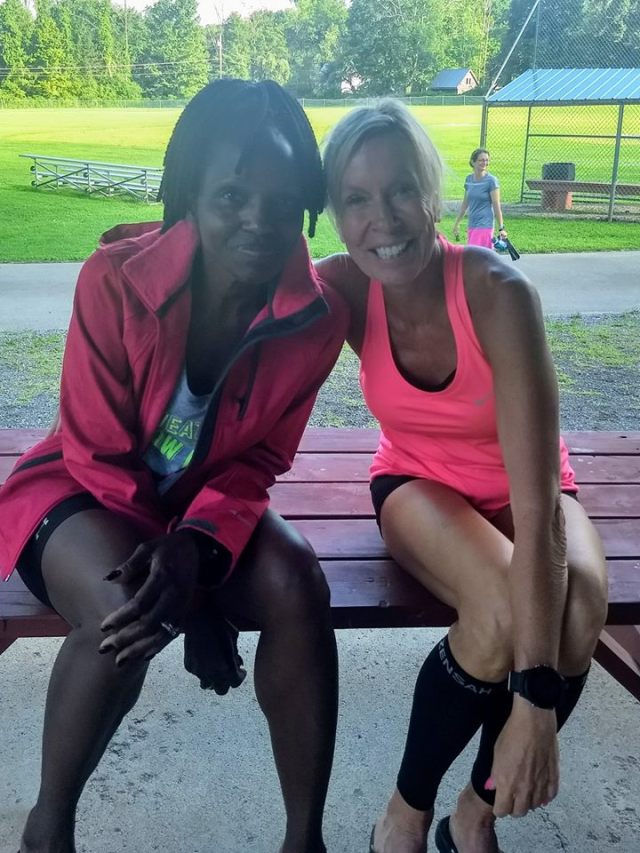 their 50s, and have each completed 50-mile races before. They are the 1st ever to complete the course as a team of two, and their performance at this year’s CMRR was a fantastic accomplishment if there ever was one. Great job, ladies !
____________________
Getting back to the solo race, Woodstock, NY’s Jack Ryon finished 2nd among the men in 11:12:59, followed by Jonathan Smit of Warwick, NY in 11:17:01. Rounding out the top three on the ladies side were Sheryl Wheeler of Rhinebeck, NY and Stephanie Dar of Johnsonville, NY, finishing in 11:27:02 and 13:29:10, respectively.
All told, ten of the eleven solo starters made it to West Shokan within the allotted 15 hours and 30 minutes. The final two were Tacy Powers and Julie Lyness, friends who live near each other along the Delaware/Maryland border, and who paced each other for most of the race. In finishing, Julie became one of a very short list of athletes to successfully complete the solo race three times.
____________________
As I have said several times, I consider it an immense privilege to direct this race, and 2018 is now my 5th year as lead organizer. But as we all know, no race can go on without a lot of support, and I want to give genuine thanks where thanks are due.
First, to the aforementioned race volunteers Melissa McCutcheon, Chad Smith and Paul Reynolds. They spent the majority of their Sunday helping our runners to have a positive experience, and I convey to them my deepest gratitude.
Second is to race founder Brian Cavanagh, who was instrumental in bringing me in as  the race director after the race began showing signs of failing five years ago. He has a plethora of historical and technical knowledge, and this race is all the better on account of his continued involvement in it.
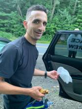
Thirdly, I want to thank all of the folks who crewed for our solo runners. They may not be thought of as traditional volunteers, but they all had a very long day, which began as early as 2:00am when they were asked to arise from their slumber, get their runner and his/her gear into the car, and drive to the start line.
And lastly, I wish to give shoutouts to some of the folks who have committed to this event year in and year out. Scott Bartucca of the New York Harriers first came to CMRR in 2008 as part of three teams from his club. He comes back every year, and in 2018 organized six – count ‘em! – SIX teams for the race. I also want to thank Scott Batten (the other Scott B.) for helping to organize teams from his club, Dashing Whippets Running Team. Since 2014 he has worked to bring as many as four teams to the race each August, and tells me that he hopes to bring even more in years to come. Then there is Stacy Cameron, the primary identity behind the Dirty Running Scoundrels, and who has been bringing multiple teams to the event for the past five years. Also my dear friend Joe Marchesano, who was a teammate of mine that first year back in 2004, and who brought four Hudson Valley Road Warrior teams to this year’s CMRR. And finally to that great group of gals from the Scranton/Wilkes-Barre area of Pennsylvania, without whom it might feel like this event would be incomplete.
Not wanting to leave out the solo runners, I want to acknowledge the following “crazies”, for whom 100 kilometers in the Catskills doesn’t seem to be enough, and who are compelled to keep returning:
3-Time Solo Finishers
Christopher Regan – 2015, 2016, 2017
Phil Cappuccio – 2016, 2017, 2018
Julie Lyness – 2016, 2017, 2018
2-Time Solo Finishers
Jordan Grande – 2014, 2015
Timothy Burns – 2014, 2017
Melissa McCutcheon – 2015, 2016
Roni Belcheva – 2016, 2017
Frankie Swaha – 2016, 2017
Erin Willett – 2016, 2017
Stephanie Dar – 2017, 2018
Tacy Powers – 2017, 2018
_________________________
I hope all of you – runners, crews and volunteers – had a great experience this year, and will carry the memories of it with you as summer turns to Fall and the frost begins forming on the pumpkin. Stay tuned for the opening of registration for next year’s race, hopefully in late-January 2019.
=Todd=

 I traveled from the Lower Hudson Valley with my friend and hiking pal Bob Harris to knock off two of the highest peaks on our list, with Lyon Mountain being the first of those two. The drive from our hotel in Lake Placid was about 55 minutes, and consisted mainly of back roads through the towns of Wilmington, Silver Lake, Redford, and then Saranac (not to be confused with Saranac Lake) before we ultimately found the unmaintained road to the trailhead, located next to Chazy Lake.
 The map that I had pulled up on Alltrails.com showed at least 10 or 11 switchbacks that we would encounter on our 3.35-mile trek to the summit. Along the way, I annoyed Bob numerous times by stopping to take pictures of mushrooms, a bit of a trail “fetish” that I had recently acquired. It seemed as though every twist and turn brought forth a new and different mushroom to photograph.
 couple about our age with two beautiful dogs in tow. They informed us that we were approximately 20 mins from the summit, and the lady said “that last half mile is kinda steep”. It turned out to be not as steep as I expected, but the real issue was that the trail was rocky, and was also essentially a stream from recent rains.
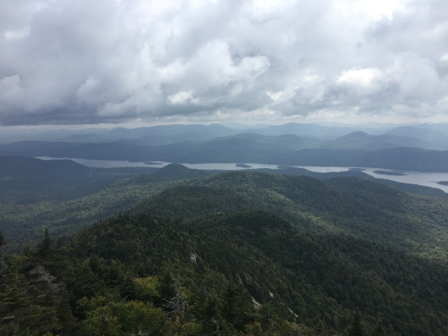
 The vistas to the east and northeast were remarkable, giving us a broad view to the east of Lake Champlain and Vermont in the distance, along with dozens of windmills in the foreground below us (this part of the state is rife with wind farms). To the south, you could see the High Peaks region 40-50 miles away, with Whiteface Mountain – easily identifiable by its pyramid shape – situated at the center of it all.
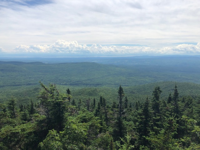
 pecifically either of us) have to complain about being in a place like this, you’re probably not doing it right.” I’m paraphrasing him, but that was the gist of his comment.


")


![IMG_3376[1]](https://trailtodd.files.wordpress.com/2018/02/img_33761.jpg)


 All of the ponds were lovely, and just prior to reconnecting with the trail we had gone in on, we passed a body of water that was not on any Google or trail maps. But yet it was there, a small, swampy pond that had accumulated enough water to make a bog bridge necessary in order for us to successfully pass by.


 mentioned in several trip reports I had read about reaching this county high point. (Note: I learned in researching this article that Ray passed away in 2015)
 the underbrush was very light. Picking the high spot that was nearest to the given coordinates I had taken from Peakbagger.com, I noted the elevation at 1477′, some 20 feet higher than the “official” altitude. But knowing that not all compasses read the same, I was satisfied with the latitude and longitude readings, especially given that there was no other ground higher than where I was standing.


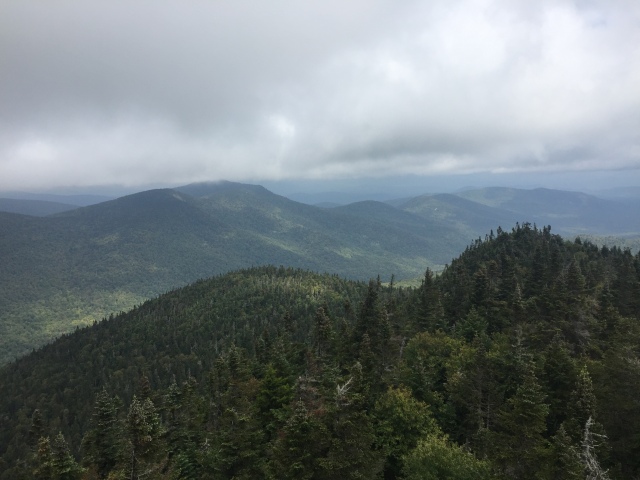
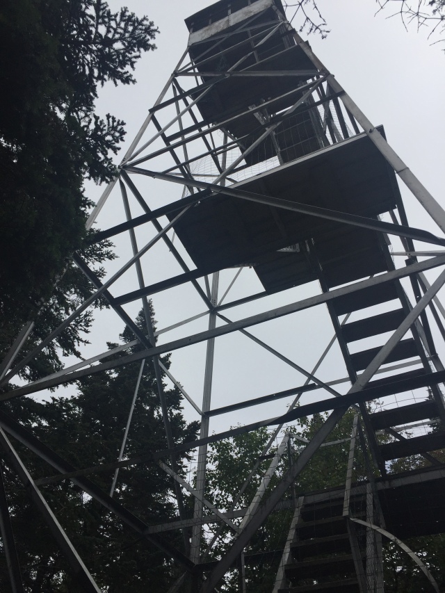
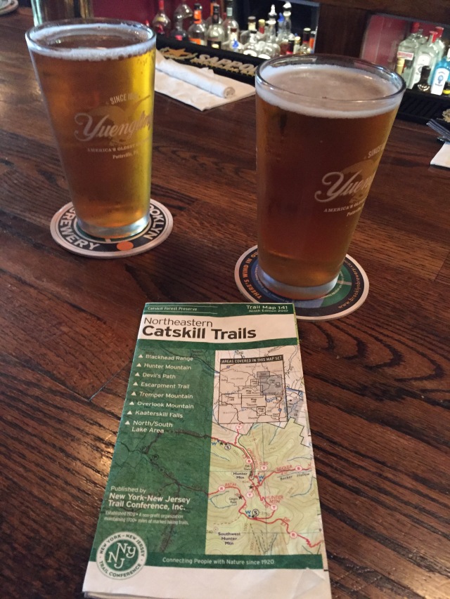
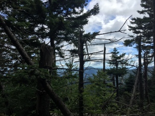 After 1 hr and 52 minutes, we found ourselves at the Hunter Mountain summit, complete with ranger cabin,

 Dreams In Action – Marshall Ulrich
 Lisa Smith-Batchen's Blog
 Notes on a Running Life – Douglas Hegley
 rundangerously
 The Long Brown Path
 NYCRUNS
 Philip Melillo Health & Fitness